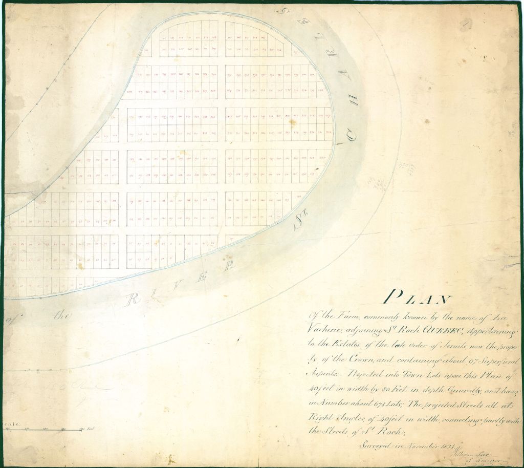
Plan of the farm commonly known by the name of La Vacherie, adjoining St Roch Quebec, appertaining to the Estates of the late order of Jesuits, now the porperty of the Crown and containing about 97 superficial arpents. Projected into town lots upon this plan of 40 feet in width by 80 feet in depth generally and being in number about 671 lots; the projected streets all at right angles of 40 feet in width connecting partly with the streets of St Roch.
Voir les informations
Détails du document
Informations détaillées
- Conditions générales d'utilisation :
-

- Titre :
- Plan of the farm commonly known by the name of La Vacherie, adjoining St Roch Quebec, appertaining to the Estates of the late order of Jesuits, now the porperty of the Crown and containing about 97 superficial arpents. Projected into town lots upon this plan of 40 feet in width by 80 feet in depth generally and being in number about 671 lots; the projected streets all at right angles of 40 feet in width connecting partly with the streets of St Roch.
- Créateur :
- William Saxe
- Date de création :
- 1821-11-01
- Genre spécifique :
-
- Seigneurie de Lavacherie. Plan de la ferme Lavacherie située à la Pointe-aux-Lièvres montrant sa subdivision en lots
-
- Seigneurie de Lavacherie. Plan de la ferme Lavacherie située à la Pointe-aux-Lièvres montrant sa subdivision en lots
- Sujet traité :
- Notice détaillée :
- Collections et fonds :
- Lieu de conservation :
-
Lien :Le lien est la meilleure manière de partager ou de conserver une ressource. Il est basé sur l'ARK (Archival Resource Key), un identifiant pérenne. Seules les suppressions et les nouvelles numérisations pourraient rendre ce lien invalide.
-
Fichier (1)
Ce document ne peut être affiché par le visualiseur. Vous devez le télécharger pour le voir.
Document disponible pour consultation sur les postes informatiques sécurisés dans les édifices de BAnQ. À la Grande Bibliothèque, présentez-vous dans l'espace de la Bibliothèque nationale, au niveau 1.