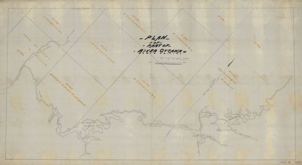
Plan of part of River Ottawa : from Henry O'Sullivan survey
Voir les informations
Détails du document
Informations détaillées
- Conditions générales d'utilisation :
-

- Titre :
- Plan of part of River Ottawa : from Henry O'Sullivan survey
- Créateur :
- Paul T.C. Dumais
- Date de création :
- 1890
- Genre spécifique :
-
- Cette unité de description comprend des informations concernant :THOMSON, R. & CO., BOURQUE, ROCHON & CHAMPAGNE, ROCHON, CHAMPAGNE, EGAN, POUPORE & BRYSON, POUPORE, BRYSON, BOURQUE, JOS., OUTAOUAIS, RIVIÈRE DES (QUÉBEC ET ONT.) -- CONCESSIONS FORESTIÈRES, CONCESSIONS FORESTIÈRES -- PONTIAC (COMTÉ : QUÉBEC)
- Sujets traités :
- Notice détaillée :
- Collections et fonds :
- Lieu de conservation :
-
Lien :Le lien est la meilleure manière de partager ou de conserver une ressource. Il est basé sur l'ARK (Archival Resource Key), un identifiant pérenne. Seules les suppressions et les nouvelles numérisations pourraient rendre ce lien invalide.
-
Fichier (1)
Ce document ne peut être affiché par le visualiseur. Vous devez le télécharger pour le voir.
Document disponible pour consultation sur les postes informatiques sécurisés dans les édifices de BAnQ. À la Grande Bibliothèque, présentez-vous dans l'espace de la Bibliothèque nationale, au niveau 1.