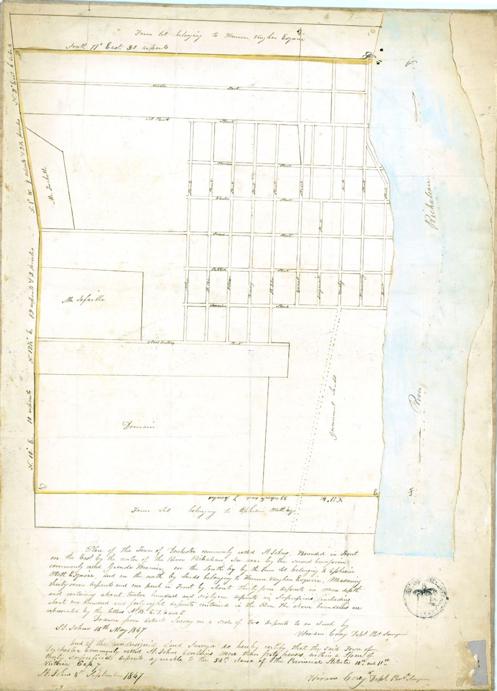
Plan of the town of Dorchester commonly called St. Johns. Bounded in front on the east by the center of the river Richaleau, in near by the second Concession commonly called Grande Bernier on the south by the farm lot belonging to Ephrain Mott Esquire and on the north by lands belonging to Harmon Vaughan Esquire, measuring thirty seven arpents and on perch in front by about thirty four arpents in mean depth and containing about twelve hundred and sixty one arpents in superficies including about one hundred and forty eight arpents contained in the river the above boundaries are represented by the letters A. B. C. D. E. and F.
Voir les informations
Détails du document
Informations détaillées
- Conditions générales d'utilisation :
-

- Titre :
- Plan of the town of Dorchester commonly called St. Johns. Bounded in front on the east by the center of the river Richaleau, in near by the second Concession commonly called Grande Bernier on the south by the farm lot belonging to Ephrain Mott Esquire and on the north by lands belonging to Harmon Vaughan Esquire, measuring thirty seven arpents and on perch in front by about thirty four arpents in mean depth and containing about twelve hundred and sixty one arpents in superficies including about one hundred and forty eight arpents contained in the river the above boundaries are represented by the letters A. B. C. D. E. and F.
- Créateur :
- Hiram Corey
- Date de création :
- 1847-05-15
- Genre spécifique :
-
- Village de Dorchester (ville Saint-Jean). Seigneurie de Longueuil
-
- Village de Dorchester (ville Saint-Jean). Seigneurie de Longueuil
- Sujets traités :
- Notice détaillée :
- Collections et fonds :
- Lieu de conservation :
-
Lien :Le lien est la meilleure manière de partager ou de conserver une ressource. Il est basé sur l'ARK (Archival Resource Key), un identifiant pérenne. Seules les suppressions et les nouvelles numérisations pourraient rendre ce lien invalide.
-
Fichier (1)
Ce document ne peut être affiché par le visualiseur. Vous devez le télécharger pour le voir.
Document disponible pour consultation sur les postes informatiques sécurisés dans les édifices de BAnQ. À la Grande Bibliothèque, présentez-vous dans l'espace de la Bibliothèque nationale, au niveau 1.